AAU Herbarium Database |
| New Search Modify Search |
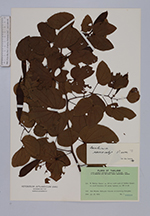
| Collector | Napper, D.M. |
| Number | 2169 |
| Collected with | J.B.Gillett, P.R.O.Bally |
| Country | Kenya |
| Subpart | |
| County | |
| Locality | Teita District, Kasigau Mt. A steep granite mountain rising with great cliffs and very steep slopes 1000 m above the surrounding plain, its lower slopes bearing dense thicket & scrub-forest repalced by rainforest with scanty undergrowth but many epiphtes about 1/2 way up, the uppermost slopes with a dense Mimulopsis understory; rainforest. |
| Coordinates | |
| Minimum elevation (m) | 1200 |
| Maximum elevation (m) | 1200 |
| Start date | 1969/06/01 |
| End date | 1969/06/01 |
| Family | Aspleniaceae |
| Identification | Asplenium dregeanum Kunze |
| Determined by | |
| Identification qualifier | |
| Field notes | Many epiphytes about 1/2 way up. |
| |
| This record has no coordinates. Display map with the 7 georeferenced records of Asplenium dregeanum in the AAU Herbarium Database. |
| New Search Modify Search |