AAU Herbarium Database |
| New Search Modify Search |
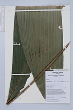
| Collector | Harris, D. J. |
| Number | 3769 |
| Collected with | |
| Country | Cameroon |
| Subpart | |
| County | |
| Locality | Mount Cameroon. Onge. Transect 5 km west from west bank of Onge River. |
| Coordinates | 4° 18' N 8° 57' E |
| Minimum elevation (m) | 100 |
| Maximum elevation (m) | 100 |
| Start date | 1993/10/11 |
| End date | 1993/10/11 |
| Family | Arecaceae |
| Identification | Oncocalamus |
| Determined by | |
| Identification qualifier | |
| Field notes | Sapling in seasonally flooded forest beside river. Clump consisting of 10 leaves with petioles up to 1.5 m long and without any extension to the rachis. In addition two stems up to 3 m long with leaves which have extensions with hooks. Spines on stem and on ochrea of these leaves but some ochreas have their spines falling off. |
| |
 Other records of Oncocalamus Other records of OncocalamusThe map displays only records from the Aarhus Herbarium Database. The records may not represent the full distribution of Oncocalamus |
| New Search Modify Search |