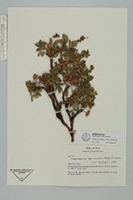
| Collector | Boertmann, D. |
| Number | 141 |
| Collected with | |
| Country | Peru |
| Subpart | Puno |
| County | |
| Locality | Pampa Chaganchaca, between Lampa and Pucara. |
| Coordinates | 15° 10' S 70° 22' W |
| Minimum elevation (m) | 3800 |
| Maximum elevation (m) | 3800 |
| Start date | 1987/04/02 |
| End date | 1987/04/02 |
| Family | Rosaceae |
| Identification | Polylepis incarum (Bitter)M. Kessler & Schmidt-Leb. |
| Determined by | T.E. Boza E. |
| Identification qualifier | |
| Field notes | Tree 6 m. tall, from open forest on hill side. Some Buddleja inter mixed among the Polylepis. |
|
 Other records of Polylepis incarum