AAU Herbarium Database |
| New Search Modify Search |
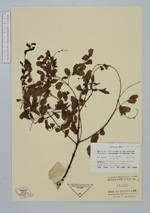
| Collector | Foreman, D.B. |
| Number | NGF48462 |
| Collected with | P. Katik |
| Country | Papua New Guinea |
| Subpart | Western District |
| County | |
| Locality | 5 miles N of Kiunga on road to Rumingae. Lowland rainforest. |
| Coordinates | 6° 10' S 141° 20' E |
| Minimum elevation (m) | 100 |
| Maximum elevation (m) | 100 |
| Start date | 1971/08/19 |
| End date | 0/00/00 |
| Family | Fabaceae |
| Identification | Adenanthera |
| Determined by | |
| Identification qualifier | |
| Field notes | Small tree, bole crooked; height 30 feet, d.b.h. 6 ins; bark brown with green lichen patches; under bark reddish-brown; wood pale yellow; leaves bright green; flower buds greenish-white |
| |
 Other records of Adenanthera Other records of AdenantheraThe map displays only records from the Aarhus Herbarium Database. The records may not represent the full distribution of Adenanthera |
| New Search Modify Search |