AAU Herbarium Database |
| New Search Modify Search |
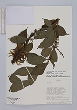
| Collector | Ceron, C.E. |
| Number | 6650 |
| Collected with | |
| Country | Ecuador |
| Subpart | Napo |
| County | |
| Locality | Cantón Archidona. Carretera Hollín-Loreto, Km 50. Comunidad Guagua Sumaco. Faldas al sur del Volcán Sumaco. Bosque muy húmedo Premontano. Informante: Pedro Avilés. |
| Coordinates | 0° 38' S 77° 27' W |
| Minimum elevation (m) | 100 |
| Maximum elevation (m) | 100 |
| Start date | 1989/04/29 |
| End date | 1989/05/02 |
| Family | Rubiaceae |
| Identification | Randia armata (Sw.)DC. |
| Determined by | |
| Identification qualifier | |
| Field notes | Arbolito de 6 m. espinoso. Frutos redondos ovalados, de 2 cm. de largo, verdes. Cáliz persistente en ápice del fruto. |
| |
 Other records of Randia armata Other records of Randia armataThe map displays only records from the Aarhus Herbarium Database. The records may not represent the full distribution of Randia armata |
| New Search Modify Search |