AAU Herbarium Database |
| New Search Modify Search |
| Collector | Heatubun, C.D. |
| Number | CH194 |
| Collected with | et al. |
| Country | Indonesia |
| Subpart | Irian Jaya |
| County | |
| Locality | Fak-Fak. Timika. East Levee be drowned forest, 5 km S of Kpg Kali Kopi. Loc 11. Destroyed Swamp Forest. |
| Coordinates | 4° 39' 4'' S 136° 55' 4'' E |
| Minimum elevation (m) | 20 |
| Maximum elevation (m) | 20 |
| Start date | 1998/02/18 |
| End date | 1998/02/18 |
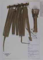
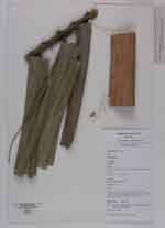
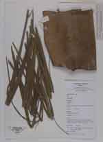
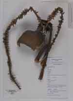
| Family | Arecaceae |
| Identification | Cyrtostachys |
| Determined by | |
| Identification qualifier | |
| Field notes | Clustering medium palm, tall 15 m high, stem hard, diameter 30 cm, leaves pinnate, 300 cm long, 101 leaflets. Inflorescences lateral, divaricate, 75 cm long |
| |
 Other records of Cyrtostachys Other records of CyrtostachysThe map displays only records from the Aarhus Herbarium Database. The records may not represent the full distribution of Cyrtostachys |
| New Search Modify Search |