AAU Herbarium Database |
| New Search Modify Search |
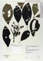
| Collector | BMA, |
| Number | 304 |
| Collected with | |
| Country | Bolivia |
| Subpart | La Paz |
| County | |
| Locality | Prov. Nor Yungas, Cotapata, Estación Biológica de Tunquini, senda a la cascada detras de EBT, como 50 mts mas abajo de tome de agua (dique de cemento), subiendo hacia la izquierda |
| Coordinates | 16° 11' S 67° 52' W |
| Minimum elevation (m) | 1680 |
| Maximum elevation (m) | 1680 |
| Start date | 2001/09/29 |
| End date | 2001/09/29 |
| Family | Melastomataceae |
| Identification | Axinaea |
| Determined by | |
| Identification qualifier | |
| Field notes | Bosque Humedo Montano de los Yungas. Arbol, 7.00 m., estéril |
| |
 Other records of Axinaea Other records of AxinaeaThe map displays only records from the Aarhus Herbarium Database. The records may not represent the full distribution of Axinaea |
| New Search Modify Search |