AAU Herbarium Database |
| New Search Modify Search |
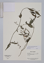
| Collector | Staahl, B. |
| Number | 2463 |
| Collected with | P. Asimbaya, J.T. Knudsen & H. navarrete |
| Country | Ecuador |
| Subpart | Sucumbios |
| County | |
| Locality | San Rafael, ca. 48 km NE of El Chaco. Primary forest |
| Coordinates | 0° 6' S 77° 35' W |
| Minimum elevation (m) | 1400 |
| Maximum elevation (m) | 1400 |
| Start date | 1996/05/09 |
| End date | 1996/05/09 |
| Family | Rubiaceae |
| Identification | Manettia paniculata Poepp. & Endl. |
| Determined by | J.H. Kirkbride, Jr. |
| Identification qualifier | |
| Field notes | Vine, corolla green |
| |
 Other records of Manettia paniculata Other records of Manettia paniculataThe map displays only records from the Aarhus Herbarium Database. The records may not represent the full distribution of Manettia paniculata |
| New Search Modify Search |