AAU Herbarium Database |
| New Search Modify Search |
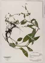
| Collector | Staahl, B. |
| Number | 2273 |
| Collected with | H. Navarrete |
| Country | Ecuador |
| Subpart | Napo |
| County | |
| Locality | About 3 km W of Oyacachi. |
| Coordinates | 0° 12' S 78° 6' W |
| Minimum elevation (m) | 3550 |
| Maximum elevation (m) | 3550 |
| Start date | 1996/03/27 |
| End date | 1996/03/27 |
| Family | Boraginaceae |
| Identification | Hackelia revoluta (Ruiz & Pav.)I.M. Johnst. |
| Determined by | H.H.Hilger & M.Weigend |
| Identification qualifier | |
| Field notes | Low dense forest with Escallonia and Polylepis. Herb, corolla white |
| |
 Other records of Hackelia revoluta Other records of Hackelia revolutaThe map displays only records from the Aarhus Herbarium Database. The records may not represent the full distribution of Hackelia revoluta |
| New Search Modify Search |