| Collector | Ollgaard, B. |
| Number | 99975 |
| Collected with | |
| Country | Ecuador |
| Subpart | SUCUMBIOS |
| County | |
| Locality | Road to La Bonita, km 59.1 from southern junction to Panamerican Highway. Montane cloudforest around stream. |
| Coordinates | 0° 30' N 77° 30' W |
| Minimum elevation (m) | 2150 |
| Maximum elevation (m) | 2150 |
| Start date | 1991/12/05 |
| End date | 1991/12/05 |
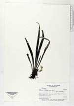
| Family | Vittariaceae |
| Identification | Antrophyum lineatum (Sw.)Kaulf. |
| Determined by | Moran, R.C. (AAU), 1993. |
| Identification qualifier | |
| Field notes | Succulent epiphyte in shade. |
|
 Other records of Antrophyum lineatum