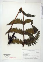
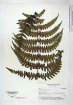
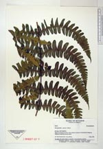
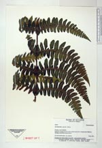
| Collector | Ollgaard, B. |
| Number | 99973 |
| Collected with | |
| Country | Ecuador |
| Subpart | SUCUMBIOS |
| County | |
| Locality | Road to La Bonita, km 59.1 from southern junction to Panamerican Highway. Montane cloudforest around stream. |
| Coordinates | 0° 30' N 77° 30' W |
| Minimum elevation (m) | 2150 |
| Maximum elevation (m) | 2150 |
| Start date | 1991/12/05 |
| End date | 1991/12/05 |
| Family | Dennstaedtiaceae |
| Identification | Dennstaedtia sprucei T. Moore |
| Determined by | |
| Identification qualifier | |
| Field notes | On steep rock wall in shade at waterfall. Leaves pendent-scandent. |
|
 Other records of Dennstaedtia sprucei