| Collector | Ollgaard, B. |
| Number | 99071 |
| Collected with | Blasco, M. |
| Country | Ecuador |
| Subpart | NAPO |
| County | |
| Locality | "Upper Río Tiputini, ca. 2 canoe-hours from bridge on Coca-Auca-oilfield road. Tropical rain forest." |
| Coordinates | 0° 43' S 76° 57' W |
| Minimum elevation (m) | 300 |
| Maximum elevation (m) | 300 |
| Start date | 1991/07/21 |
| End date | 1991/07/23 |
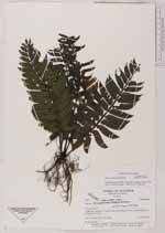
| Family | Marattiaceae |
| Identification | Danaea lanceolata Tuomisto & Keskiniva |
| Determined by | H. Turmisto & V. Keskiniva |
| Identification qualifier | |
| Field notes | On stream bank. |
|
 Other records of Danaea lanceolata