AAU Herbarium Database |
| New Search Modify Search |
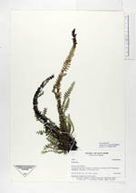
| Collector | Ollgaard, B. |
| Number | 99023 |
| Collected with | |
| Country | Ecuador |
| Subpart | PICHINCHA |
| County | |
| Locality | Estación Biológica Río Guajalito, in Quebrada Las Palmeras, km 59 along road Chillogallo-Alluriquín. Tall montane forest. |
| Coordinates | 0° 14' S 78° 47' W |
| Minimum elevation (m) | 1900 |
| Maximum elevation (m) | 1800 |
| Start date | 1991/06/16 |
| End date | 1991/06/16 |
| Family | Grammitidaceae |
| Identification | Terpsichore communis Moguel |
| Determined by | Moguel,A.L. |
| Identification qualifier | |
| Field notes | Pendulous on shaded rock wall at stream. |
| |
 Other records of Terpsichore communis Other records of Terpsichore communisThe map displays only records from the Aarhus Herbarium Database. The records may not represent the full distribution of Terpsichore communis |
| New Search Modify Search |