| Collector | Ollgaard, B. |
| Number | 98788 |
| Collected with | |
| Country | Ecuador |
| Subpart | NAPO |
| County | |
| Locality | Trail from Campamento San Rafael (INECEL) to Cascadas San Rafael (Río Quijos). Wet montane forest. |
| Coordinates | 0° 6' S 77° 35' W |
| Minimum elevation (m) | 1300 |
| Maximum elevation (m) | 1300 |
| Start date | 1991/01/20 |
| End date | 1991/01/20 |
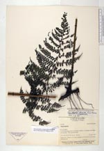
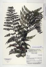
| Family | Dennstaedtiaceae |
| Identification | Dennstaedtia cornuta (Kaulf.)Mett. |
| Determined by | Navarrete, H. & Ollgaard, B. (AAU), 1999 |
| Identification qualifier | |
| Field notes | Along trail. Leaves to 4 m long, scandent, with bulbils in pinna and pinnule axils. |
|