| Collector | Ollgaard, B. |
| Number | 98696 |
| Collected with | Korning, J. & Krogstrup, K. |
| Country | Ecuador |
| Subpart | ESMERALDAS |
| County | |
| Locality | Road Lita-Urbina (under construction), km 38.8. Wet forest on slope along small river. |
| Coordinates | 0° 47' N 78° 35' W |
| Minimum elevation (m) | 500 |
| Maximum elevation (m) | 450 |
| Start date | 1991/01/12 |
| End date | 1991/01/12 |
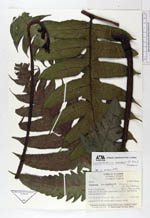
| Family | Dryopteridaceae |
| Identification | Diplazium sanderi (C. Chr.) Pacheco |
| Determined by | Pacheco, L. (UAMIZ), 1992. |
| Identification qualifier | |
| Field notes | Leaves to 2.5 m tall, with broadly triangular lamina. |
|
 Other records of Diplazium sanderi