| Collector | Ollgaard, B. |
| Number | 98652 |
| Collected with | Jorgensen, P. M. & Ulloa, C. |
| Country | Ecuador |
| Subpart | AZUAY |
| County | |
| Locality | Road Chiquintad-Planta Hidroelectrica Chanlud-Tuni, km 26.9, at Presa Chanlud. Grass páramo with exposed rock walls and adjacent scrub forest. |
| Coordinates | 2° 40' S 78° 2' W |
| Minimum elevation (m) | 3500 |
| Maximum elevation (m) | 3400 |
| Start date | 1990/12/29 |
| End date | 1990/12/29 |
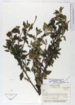
| Family | Grossulariaceae |
| Identification | Ribes erectum Freire-F. |
| Determined by | Freire-Fierro, A. (QCA), 1994. |
| Identification qualifier | |
| Field notes | C. 3 m tall shrub. Flowers pale greenish. |
|
 Other records of Ribes erectum