| Collector | Ollgaard, B. |
| Number | 98023 |
| Collected with | |
| Country | Ecuador |
| Subpart | PICHINCHA |
| County | |
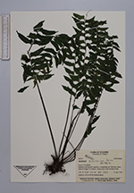
| Locality | Estación Científica Río Guajalito, in Quebrada Las Palmeras, along road Chiriboga-El Transito. Along trail in wet montane forest. |
| Coordinates | 0° 14' S 78° 47' W |
| Minimum elevation (m) | 1930 |
| Maximum elevation (m) | 1800 |
| Start date | 1990/06/10 |
| End date | 1990/06/10 |
| Family | Aspleniaceae |
| Identification | Asplenium pululahuae Sod. |
| Determined by | Ollgaard, B. (AAU), 1991. |
| Identification qualifier | |
| Field notes | Epiphyte, with arching-hanging leaves. |
|
 Other records of Asplenium pululahuae