| Collector | Ollgaard, B. |
| Number | 98018 |
| Collected with | |
| Country | Ecuador |
| Subpart | PICHINCHA |
| County | |
| Locality | Estación Científica Río Guajalito, in Quebrada Las Palmeras, along road Chiriboga-El Transito. Along trail in wet montane forest. |
| Coordinates | 0° 14' S 78° 47' W |
| Minimum elevation (m) | 1930 |
| Maximum elevation (m) | 1800 |
| Start date | 1990/06/10 |
| End date | 1990/06/10 |
| Family | Dryopteridaceae |
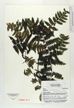
| Identification | Diplazium angulosum C. Chr. |
| Determined by | Stolze, R.G. (F), 1992. |
| Identification qualifier | |
| Field notes | Large terrestrial fern, with up to 5 m long arching, subscandent leaves. Stipes c. 2 m long. Lamina ovate-lanceolate in outline. |

|
 Other records of Diplazium angulosum