AAU Herbarium Database |
| New Search Modify Search |
| Collector | Ollgaard, B. |
| Number | 9641 |
| Collected with | Balslev, H. |
| Country | Ecuador |
| Subpart | LOJA |
| County | |
| Locality | Muletrack Amaluza - Palanda, western slope, near the pass (W of Laguna Chuquiragua). Grass páramo with patches of montane forest with large trees in protected places. |
| Coordinates | 4° 35' S 79° 20' W |
| Minimum elevation (m) | 3100 |
| Maximum elevation (m) | 3400 |
| Start date | 1976/09/22 |
| End date | 1976/09/22 |
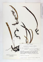
| Family | Polypodiaceae |
| Identification | Campyloneurum angustifolium (Sw.)Fée |
| Determined by | B. Ollgaard, 1983 |
| Identification qualifier | |
| Field notes | Epiphyte on a large tree. |
| |
| Display all 48 georeferenced records of Campyloneurum Campyloneurum angustifolium |
| New Search Modify Search |