| Collector | Ollgaard, B. |
| Number | 90771 |
| Collected with | |
| Country | Ecuador |
| Subpart | LOJA/ZAMORA-CHINCHIPE |
| County | |
| Locality | Parque Nacional Podocarpus. Crest of the Cordillera de los Andes E and SE of Nudo de Cajanuma, along trail from 'Centro de Informacion' toward Lagunas del Compadre. |
| Coordinates | 4° 6' S 79° 10' W |
| Minimum elevation (m) | 3250 |
| Maximum elevation (m) | 3350 |
| Start date | 1989/03/02 |
| End date | 1989/03/02 |
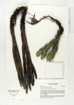
| Family | Lycopodiaceae |
| Identification | Huperzia kuesteri (Nessel)B. Øllg. |
| Determined by | |
| Identification qualifier | |
| Field notes | Common on exposed areas. Plant glaucous green. |
|
 Other records of Huperzia kuesteri