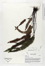
| Collector | Ollgaard, B. |
| Number | 90640 |
| Collected with | |
| Country | Ecuador |
| Subpart | ZAMORA-CHINCHIPE |
| County | |
| Locality | Parque Nacional Podocarpus. Road Yangana-Valladolid, just S and E of the pass (Nudo de Sabanilla). Muletrack from pass toward Quebrada Honda. |
| Coordinates | 4° 27' S 79° 8' W |
| Minimum elevation (m) | 2750 |
| Maximum elevation (m) | 2950 |
| Start date | 1989/02/18 |
| End date | 1989/02/18 |
| Family | Pteridaceae |
| Identification | Jamesonia verticalis Kunze |
| Determined by | Arbelaez, A. L. (MO), 2000. |
| Identification qualifier | |
| Field notes | On sheltered trail bank, leaves arching. |
|
 Other records of Jamesonia verticalis