AAU Herbarium Database |
| New Search Modify Search |
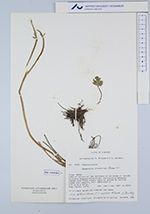
| Collector | Ollgaard, B. |
| Number | 8910 |
| Collected with | Balslev, H. |
| Country | Ecuador |
| Subpart | NAPO |
| County | |
| Locality | Lake at origin of Río Antisana on SW slope of Volcán Antisana (Laguna Micacocha), surrounding páramos, swampy and rocky areas, heavely grazed by cattle, sheep and rabbits. |
| Coordinates | 0° 31' S 78° 11' W |
| Minimum elevation (m) | 3900 |
| Maximum elevation (m) | 4100 |
| Start date | 1976/08/21 |
| End date | 1976/08/22 |
| Family | Ranunculaceae |
| Identification | Ranunculus praemorsus H.B.K. ex DC. |
| Determined by | B. Ståhl |
| Identification qualifier | |
| Field notes | On a humid landslide towards the lake. |
| |
| Display all 57 georeferenced records of Ranunculus Ranunculus praemorsus |
| New Search Modify Search |