AAU Herbarium Database |
| New Search Modify Search |
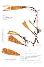
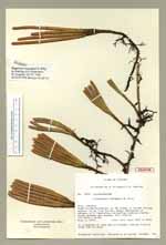
| Type of: | Huperzia hypogaea B. Øllg. |
| Collector | Ollgaard, B. |
| Number | 8517 |
| Collected with | Balslev, H. |
| Country | Ecuador |
| Subpart | CARCHI |
| County | |
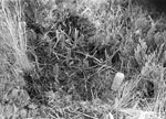
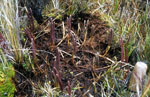
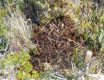
| Locality | Road Tulcán - Maldonado, on SW slopes of Volcán Chiles, approx. 43 km from Tulcán. Boggy depression in páramo, with Espeletia, Loricaria, cushion plants, bunch grasses and mosses. |
| Coordinates | 0° 48' N 77° 59' W |
| Minimum elevation (m) | 3740 |
| Maximum elevation (m) | 3740 |
| Start date | 1976/08/06 |
| End date | 1976/08/06 |
| Family | Lycopodiaceae |
| Identification | Huperzia hypogaea B. Øllg. |
| Determined by | Ollgaard, B. (AAU), 1988. |
| Identification qualifier | |
| Field notes | In a cushion of moss and Ericaceae. Stolons 5-10 cm under the surface. |
| |
| Display all 78 georeferenced records of Huperzia Huperzia hypogaea |
| New Search Modify Search |