| Collector | Ollgaard, B. |
| Number | 8222 |
| Collected with | Balslev, H. |
| Country | Ecuador |
| Subpart | NAPO |
| County | |
| Locality | Road Quito-Baeza, along take-off road to telecommunication antenna in the pass (Páramo de Guamaní). Bunch grass páramo and boggy páramo with small lakes and a few shrubs. |
| Coordinates | 0° 17' S 78° 9' W |
| Minimum elevation (m) | 4000 |
| Maximum elevation (m) | 4100 |
| Start date | 1976/07/22 |
| End date | 1976/07/22 |
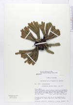
| Family | Lycopodiaceae |
| Identification | Huperzia polydactyla B.Øllg. |
| Determined by | Ollgaard, B. (AAU), 1994. |
| Identification qualifier | |
| Field notes | Growing close to no. 8223 on an old landslide of a roadbank. On nearly bare soil. Leaf tips reddish tinged. |
|
 Other records of Huperzia polydactyla