AAU Herbarium Database |
| New Search Modify Search |
| Collector | Ollgaard, B. |
| Number | 8216 |
| Collected with | Balslev, H. |
| Country | Ecuador |
| Subpart | NAPO |
| County | |
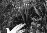
| Locality | Road Quito-Baeza, 3-4 km W of Laguna de Papallacta (Páramo de Guamaní). Rather recent SW-exposed landslide, dominated by pioneer-vegetation, mainly mosses, liverworts, several Lycopodium spp. and a few low shrubs. |
| Coordinates | 0° 19' S 78° 7' W |
| Minimum elevation (m) | 3550 |
| Maximum elevation (m) | 3550 |
| Start date | 1976/07/21 |
| End date | 1976/07/21 |
| Family | Lycopodiaceae |
| Identification | Phlegmariurus cumingii (Nessel) B.Øllg. |
| Determined by | Ollgaard, B. (AAU), 2012 |
| Identification qualifier | |
| Field notes | On a steep roadbank adjacent to a landslide. |
| |
| Display all 69 georeferenced records of Phlegmariurus Phlegmariurus cumingii |
| New Search Modify Search |