AAU Herbarium Database |
| New Search Modify Search |
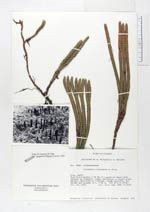
| Collector | Ollgaard, B. |
| Number | 8083 |
| Collected with | Balslev, H. |
| Country | Ecuador |
| Subpart | NAPO |
| County | |
| Locality | Road Quito-Baeza, 6 km NW of Laguna de Papallacta (Páramo de Guamaní). Boggy depression in bunch grass páramo, dominated by Plantago rigida cushions, low shrubs and mosses. |
| Coordinates | 0° 19' S 78° 7' W |
| Minimum elevation (m) | 3750 |
| Maximum elevation (m) | 3750 |
| Start date | 1976/07/19 |
| End date | 1976/07/19 |
| Family | Lycopodiaceae |
| Identification | Huperzia hypogaea B. Øllg. |
| Determined by | Ollgaard, B. (AAU), 1994. |
| Identification qualifier | |
| Field notes | |
| |
| Display all 78 georeferenced records of Huperzia Huperzia hypogaea |
| New Search Modify Search |