| Collector | Ollgaard, B. |
| Number | 74639 |
| Collected with | |
| Country | Ecuador |
| Subpart | LOJA |
| County | |
| Locality | Parque Nacional Podocarpus. E of Nudo de Cajanuma, trail E of 'Centro de Informacion' to crest on trail to Lagunas de Compadre. |
| Coordinates | 4° 5' S 79° 10' W |
| Minimum elevation (m) | 2850 |
| Maximum elevation (m) | 3050 |
| Start date | 1984/06/06 |
| End date | 1984/06/06 |
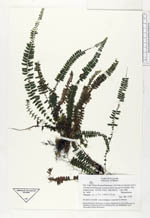
| Family | Thelypteridaceae |
| Identification | Thelypteris pusilla (Mett.)Ching |
| Determined by | Ollgaard, B. (AAU), 1996. |
| Identification qualifier | |
| Field notes | On bank at waterfall. Leaves hanging or appressed to substrate. |
|
 Other records of Thelypteris pusilla