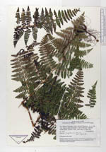
| Collector | Ollgaard, B. |
| Number | 74521 |
| Collected with | Renner, S. S. & León, B. & Young, K. |
| Country | Ecuador |
| Subpart | ZAMORA-CHINCHIPE |
| County | |
| Locality | Parque Nacional Podocarpus. At new road Loja - Zamora, under construction, c. 2 km E of the pass. |
| Coordinates | 3° 58' S 79° 6' W |
| Minimum elevation (m) | 2700 |
| Maximum elevation (m) | 2750 |
| Start date | 1984/05/26 |
| End date | 1984/05/26 |
| Family | Dennstaedtiaceae |
| Identification | Hypolepis bogotensis H. Karst. |
| Determined by | |
| Identification qualifier | |
| Field notes | In disturbed soils at road. |
|
 Other records of Hypolepis bogotensis