| Collector | Ollgaard, B. |
| Number | 57084 |
| Collected with | Korning, J. & Thomsen, K. |
| Country | Ecuador |
| Subpart | NAPO |
| County | |
| Locality | Añangu, NW corner of the "Parque Nacional Yasuní". Along SEF line in terra firme forest, near Tiputini trail. Undisturbed rain forest. |
| Coordinates | 0° 32' S 76° 22' W |
| Minimum elevation (m) | 300 |
| Maximum elevation (m) | 300 |
| Start date | 1985/01/14 |
| End date | 1985/01/22 |
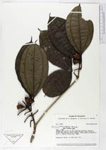
| Family | Melastomataceae |
| Identification | Blakea sawadae Macbride |
| Determined by | S. S. Renner, 1989 |
| Identification qualifier | |
| Field notes | Epiphytic shrub, at SEF point 171. |
|
 Other records of Blakea sawadae