| Collector | Ollgaard, B. |
| Number | 38530 |
| Collected with | Holm-Nielsen, L. B. & Larsen, B. B. & Kvist, L. P. & Jensen, A. R. & Wium-Andersen, S. |
| Country | Ecuador |
| Subpart | NAPO |
| County | |
| Locality | Llanganati. Paramo SE of Chosa Aucacocha, between Aucacocha and Pan de Azucar. Hilly paramo, dominated by 1-2 m high Neurolepis scrub, scattered Escallonia and Gynoxys, and Oritrophium swamps. Soil temperature 6.5° C. |
| Coordinates | 1° 9' S 78° 18' W |
| Minimum elevation (m) | 3800 |
| Maximum elevation (m) | 3900 |
| Start date | 1982/05/15 |
| End date | 1982/05/15 |
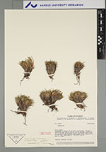
| Family | Cyperaceae |
| Identification | Oreobolus obtusangulus Gaud. |
| Determined by | O. Seberg, 1985 |
| Identification qualifier | |
| Field notes | Cushion forming. In bog. |
|