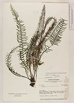
| Collector | Ollgaard, B. |
| Number | 35870 |
| Collected with | Roth, S. & Sperling, C. |
| Country | Ecuador |
| Subpart | NAPO |
| County | |
| Locality | Cerro Huacamayos, on road Baeza - Tena, c. 34 km from Baeza. Steep slope, ridge, ravine and road bank in montane rain forest. |
| Coordinates | 0° 41' S 77° 50' W |
| Minimum elevation (m) | 2000 |
| Maximum elevation (m) | 2000 |
| Start date | 1980/08/09 |
| End date | 1980/08/10 |
| Family | Grammitidaceae |
| Identification | Lellingeria bishopii Labiak |
| Determined by | P.H.Labiak |
| Identification qualifier | |
| Field notes | Pendulous epiphyte, on mossy trunk.; [Grammitis (Lellingeria) sp., det. A. R. Smith (UC), 1990.] |
|
 Other records of Lellingeria bishopii