| Collector | Ollgaard, B. |
| Number | 35568A |
| Collected with | Roth, S. & Sperling, C. |
| Country | Ecuador |
| Subpart | PASTAZA |
| County | |
| Locality | C. 5 km E of Mera, on road to Shell Mera. Rocky escarpment, road bank and riverside vegetation. |
| Coordinates | 1° 28' S 78° 5' W |
| Minimum elevation (m) | 1050 |
| Maximum elevation (m) | 1050 |
| Start date | 1980/07/30 |
| End date | 1980/07/30 |
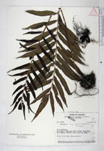
| Family | Thelypteridaceae |
| Identification | Thelypteris angustifolia (Willd.)Proctor |
| Determined by | A. R. Smith |
| Identification qualifier | |
| Field notes | On low river bank, among boulders. |
|
 Other records of Thelypteris angustifolia