| Collector | Ollgaard, B. |
| Number | 2977 |
| Collected with | P. Lozano |
| Country | Ecuador |
| Subpart | ZAMORA-CHINCHIPE |
| County | |
| Locality | Parque Nacional Podocarpus, trail into Quebrada San Francisco, km 9.4 E of pass on Loja-Zamora road. Scrub and wet montane forest along trail. |
| Coordinates | 3° 59' S 79° 6' W |
| Minimum elevation (m) | 2000 |
| Maximum elevation (m) | 2300 |
| Start date | 1998/03/25 |
| End date | 1998/03/25 |
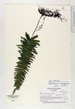
| Family | Hymenophyllaceae |
| Identification | Trichomanes dactylites Sodiro |
| Determined by | Windisch P.G. (HB), 2003. |
| Identification qualifier | |
| Field notes | On mossy, shaded bank. |
|
 Other records of Trichomanes dactylites