| Collector | Ollgaard, B. |
| Number | 2576 |
| Collected with | P. Lozano |
| Country | Ecuador |
| Subpart | ZAMORA-CHINCHIPE |
| County | |
| Locality | Río Nangaritza, trail along river S of La Wanta, 14 km SE of Guayzimi. Disturbed forest. |
| Coordinates | 4° 9' S 78° 38' W |
| Minimum elevation (m) | 900 |
| Maximum elevation (m) | 900 |
| Start date | 1997/11/13 |
| End date | 1997/11/13 |
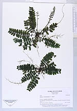
| Family | Marattiaceae |
| Identification | Danaea trichomanoides T. Moore |
| Determined by | H. Turmisto & J. Keskiniva |
| Identification qualifier | |
| Field notes | "On soil bank below rock wall; all leaves appressed to ground." |
|
 Other records of Danaea trichomanoides