AAU Herbarium Database |
| New Search Modify Search |
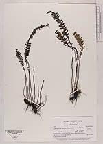
| Collector | Ollgaard, B. |
| Number | 2444 |
| Collected with | H. Navarrete |
| Country | Ecuador |
| Subpart | AZUAY |
| County | |
| Locality | Road Gualaceo-Limón, km 23, W of pass. Road bank in páramo. |
| Coordinates | 2° 59' S 78° 39' W |
| Minimum elevation (m) | 3350 |
| Maximum elevation (m) | 3350 |
| Start date | 1997/03/15 |
| End date | 1997/03/15 |
| Family | Grammitidaceae |
| Identification | Lellingeria paramicola Labiak |
| Determined by | P.H.Labiak |
| Identification qualifier | |
| Field notes | In deep moss on road bank. |
| |
 Other records of Lellingeria paramicola Other records of Lellingeria paramicolaThe map displays only records from the Aarhus Herbarium Database. The records may not represent the full distribution of Lellingeria paramicola |
| New Search Modify Search |