| Collector | Ollgaard, B. |
| Number | 2028 |
| Collected with | H. Navarrete |
| Country | Ecuador |
| Subpart | LOS RIOS |
| County | |
| Locality | Summit of Cerro Samama (Hda. Clementina), S of road Caluma-Catarama. Tall cloud forest on slope. |
| Coordinates | 1° 40' S 79° 19' W |
| Minimum elevation (m) | 700 |
| Maximum elevation (m) | 730 |
| Start date | 1996/11/13 |
| End date | 1996/11/14 |
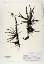
| Family | Grammitidaceae |
| Identification | Micropolypodium taenifolium (Jenman)A.R.Sm. |
| Determined by | Navarrete, H. (AAU), 1998. |
| Identification qualifier | |
| Field notes | Low epiphyte. |
|
 Other records of Micropolypodium taenifolium