AAU Herbarium Database |
| New Search Modify Search |
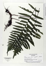
| Collector | Ollgaard, B. |
| Number | 1453 |
| Collected with | H. Navarrete |
| Country | Ecuador |
| Subpart | MORONA-SANTIAGO |
| County | |
| Locality | Mutinza, eastern foothills of Cord. Cutucú, trail to Tunantza. |
| Coordinates | 2° 11' S 77° 44' W |
| Minimum elevation (m) | 660 |
| Maximum elevation (m) | 680 |
| Start date | 1995/11/16 |
| End date | 1995/11/17 |
| Family | Polypodiaceae |
| Identification | Polypodium dulce Poir. |
| Determined by | Navarrete, H. (AAU), 1997. |
| Identification qualifier | |
| Field notes | Low epiphyte. |
| |
 Other records of Polypodium dulce Other records of Polypodium dulceThe map displays only records from the Aarhus Herbarium Database. The records may not represent the full distribution of Polypodium dulce |
| New Search Modify Search |