| Collector | Ollgaard, B. |
| Number | 1169 |
| Collected with | C. Kragelund & H. Ankersen |
| Country | Ecuador |
| Subpart | Pichincha |
| County | |
| Locality | Road from bottom of Pululahua Crater, along N side of deep quebrada to the NW, ca 17 km from Calacalí-Mitad del Mundo road. Moist forest with large mossy boulders. |
| Coordinates | 0° 4' N 78° 31' W |
| Minimum elevation (m) | 2040 |
| Maximum elevation (m) | 2040 |
| Start date | 1995/03/14 |
| End date | 1995/03/14 |
| Family | Aspleniaceae |
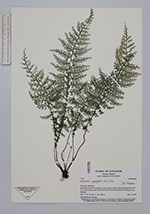
| Identification | Asplenium myriophyllum (Sw.)Presl |
| Determined by | Ankersen, H. (AAU), 1996. |
| Identification qualifier | |
| Field notes | On large mossy boulders. |
|
 Other records of Asplenium myriophyllum