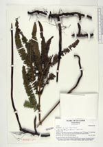
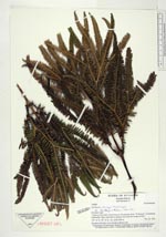
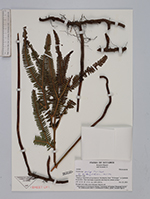
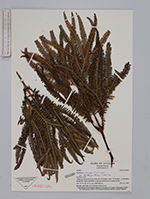
| Collector | Ollgaard, B. |
| Number | 105880 |
| Collected with | Navarrete, H. |
| Country | Ecuador |
| Subpart | Loja |
| County | |
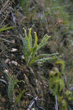
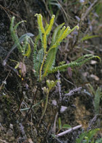
| Locality | "Trails ca 5 km ENE of San Pedro de Vilcabamba, from ""El Bosque"" to Quebrada Romerillos. Open trail banks in pastures and deep wet stream ravines." |
| Coordinates | 4° 14' S 79° 10' W |
| Minimum elevation (m) | 2100 |
| Maximum elevation (m) | 2200 |
| Start date | 1994/11/29 |
| End date | 1994/11/29 |
| Family | Gleicheniaceae |
| Identification | Sticherus penniger (Mart.)Copel. |
| Determined by | Andersen, E.O. (AAU), 1996. |
| Identification qualifier | |
| Field notes | On open trail bank, most rhizomes deep in soil. |
|
 Other records of Sticherus penniger