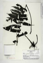
| Collector | Ollgaard, B. |
| Number | 105540 |
| Collected with | Navarrete, H. |
| Country | Ecuador |
| Subpart | Pastaza |
| County | |
| Locality | Road N of Mera, toward Río Anzu, km 6.7. Disturbed forest remnant and open Solanum quitense plantation. |
| Coordinates | 1° 26' S 78° 5' W |
| Minimum elevation (m) | 1480 |
| Maximum elevation (m) | 1480 |
| Start date | 1994/11/11 |
| End date | 1994/11/11 |
| Family | Thelypteridaceae |
| Identification | Thelypteris gardneriana (Baker)Reed |
| Determined by | Navarrete, H. (AAU), 1998. |
| Identification qualifier | |
| Field notes | On shaded forest floor. |
|
 Other records of Thelypteris gardneriana