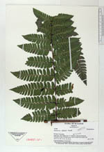
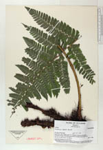
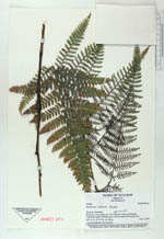
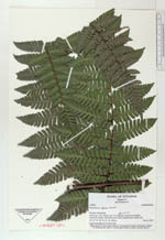
| Collector | Ollgaard, B. |
| Number | 105480 |
| Collected with | Navarrete, H. |
| Country | Ecuador |
| Subpart | Esmeraldas |
| County | |
| Locality | Road Lita-Alto Tambo, km 17.5. Entrance to Reserva Ecologica Cotacachi-Cayapa. Perhumid mossy forest on dark brown clayey soil. |
| Coordinates | 0° 53' N 78° 33' W |
| Minimum elevation (m) | 820 |
| Maximum elevation (m) | 820 |
| Start date | 1994/11/06 |
| End date | 1994/11/06 |
| Family | Dryopteridaceae |
| Identification | Polybotrya alfredii Brade |
| Determined by | Navarrete, H. (AAU), 1995. |
| Identification qualifier | |
| Field notes | Large hemiepiphyte 5 m up in tree. |
|
 Other records of Polybotrya alfredii