AAU Herbarium Database |
| New Search Modify Search |
| Collector | Torke, B.M. |
| Number | 667 |
| Collected with | Jerry Valda |
| Country | Bolivia |
| Subpart | La Paz |
| County | |
| Locality | Iturralde. "Pampas del Madidi" area of the middle reaches of the Rio Madidi basin: "Campamento Malanoche" on the N shore of the Rio Enatahua (Rio Inambari according to one guide), ca 3.5 linear km NE of the confluence of the Enatahua with the Rio Madidi, 1.5-3 km inland from camp. Savanna, much of it poorly drained, with scattered trees and termite mounds, flat to gradually sloping terrain, clay soils |
| Coordinates | 12° 55' 25'' S 67° 47' 46'' W |
| Minimum elevation (m) | 172 |
| Maximum elevation (m) | 172 |
| Start date | 2009/06/02 |
| End date | 2009/06/02 |
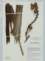
| Family | Arecaceae |
| Identification | Mauritiella armata (Mart.)Burret |
| Determined by | T.L.P. Couvreur |
| Identification qualifier | |
| Field notes | Tree, growing in wet savanna near forest edge, to ca 6 m tall |
| |
 Other records of Mauritiella armata Other records of Mauritiella armataThe map displays only records from the Aarhus Herbarium Database. The records may not represent the full distribution of Mauritiella armata |
| New Search Modify Search |