AAU Herbarium Database |
| New Search Modify Search |
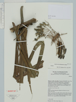
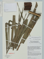
| Collector | Torke, B.M. |
| Number | 631 |
| Collected with | Jerry Valda |
| Country | Bolivia |
| Subpart | La Paz |
| County | |
| Locality | Iturralde. "Pampas del Madidi" area of the middle reaches of the Rio Madidi basin: "Campamento Malanoche" on the N shore of the Rio Enatahua (Rio Inambari according to one guide), ca 3.5 linear km NE of the confluence of the Enatahua with the Rio Madidi, 0-0.5 km downriver from camp. High river bank and poorly drained wet forest on level terrain, clay soils |
| Coordinates | 12° 56' 26'' S 67° 47' 42'' W |
| Minimum elevation (m) | 188 |
| Maximum elevation (m) | 188 |
| Start date | 2009/05/31 |
| End date | 2009/05/31 |
| Family | Arecaceae |
| Identification | Attalea |
| Determined by | M. Jeanson |
| Identification qualifier | |
| Field notes | Palm, ca 7 m tall, 35 cm dbh, trunk covered with course leaf stalks, inflorescence bract woody, brown externally, whitish internally, ca 0.75 m long, inflorescence and flowers cream, leaves ca 6 m lomg |
| |
 Other records of Attalea Other records of AttaleaThe map displays only records from the Aarhus Herbarium Database. The records may not represent the full distribution of Attalea |
| New Search Modify Search |