| Collector | Lojtnant, B. |
| Number | 15641 |
| Collected with | Molau, U. |
| Country | Ecuador |
| Subpart | PICHINCHA |
| County | |
| Locality | Old road Quito - Santo Domingo, SW of Chiriboga, km 89-90 from Quito. Secondary subtropical moist forest. |
| Coordinates | 0° 20' S 78° 52' W |
| Minimum elevation (m) | 1100 |
| Maximum elevation (m) | 1100 |
| Start date | 1979/07/08 |
| End date | 1979/07/08 |
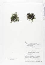
| Family | Selaginellaceae |
| Identification | Selaginella macilenta Baker |
| Determined by | Valdespino, I.A. (NY), 1995. |
| Identification qualifier | |
| Field notes | Terrestrial. |
|
 Other records of Selaginella macilenta