| Collector | Lojtnant, B. |
| Number | 14250 |
| Collected with | Molau, U. |
| Country | Ecuador |
| Subpart | CANAR |
| County | |
| Locality | Azogues - Pindilig road, km 21-22 from Azogues. Ravine in Puya-páramo with small meadows and thickets. |
| Coordinates | 2° 40' S 78° 46' W |
| Minimum elevation (m) | 3250 |
| Maximum elevation (m) | 3350 |
| Start date | 1979/06/08 |
| End date | 1979/06/08 |
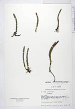
| Family | Lycopodiaceae |
| Identification | Huperzia scabrida B. Øllg. |
| Determined by | Ollgaard, B. (AAU), 1987. |
| Identification qualifier | |
| Field notes | The whole plant purple reddish suffused. |
|
 Other records of Huperzia scabrida