AAU Herbarium Database |
| New Search Modify Search |
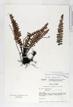
| Collector | Lojtnant, B. |
| Number | 14177 |
| Collected with | Molau, U. |
| Country | Ecuador |
| Subpart | AZUAY |
| County | |
| Locality | Cuenca - Machala road, between Girón and Santa Isabel, km 17 from Girón. Steep, dry, rocky slope with shrubs and cactae. |
| Coordinates | 3° 14' S 79° 13' W |
| Minimum elevation (m) | 1800 |
| Maximum elevation (m) | 1800 |
| Start date | 1979/06/07 |
| End date | 1979/06/07 |
| Family | Pteridaceae |
| Identification | Astrolepis sinuata (Lag.ex Sw.)D.M. Benham & Windham |
| Determined by | Arbeláez, A.L. (NY), 1996. |
| Identification qualifier | |
| Field notes | Terrestrial. |
| |
 Other records of Astrolepis sinuata Other records of Astrolepis sinuataThe map displays only records from the Aarhus Herbarium Database. The records may not represent the full distribution of Astrolepis sinuata |
| New Search Modify Search |