AAU Herbarium Database |
| New Search Modify Search |
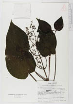
| Collector | Lojtnant, B. |
| Number | 13942 |
| Collected with | Molau, U. |
| Country | Ecuador |
| Subpart | COTOPAXI |
| County | |
| Locality | Latacunga - Quevedo road, 3-5 km above Pilaló. Slopes along road in cloud forest. |
| Coordinates | 0° 56' S 78° 59' W |
| Minimum elevation (m) | 2700 |
| Maximum elevation (m) | 2800 |
| Start date | 1979/05/28 |
| End date | 1979/05/28 |
| Family | Melastomataceae |
| Identification | Miconia crinita Naud. |
| Determined by | |
| Identification qualifier | |
| Field notes | Subshrub. Pubescence purple. Corolla white. Stamens yellow. |
| |
 Other records of Miconia crinita Other records of Miconia crinitaThe map displays only records from the Aarhus Herbarium Database. The records may not represent the full distribution of Miconia crinita |
| New Search Modify Search |