AAU Herbarium Database |
| New Search Modify Search |
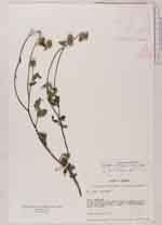
| Collector | Lojtnant, B. |
| Number | 12632 |
| Collected with | Molau, U. & Madison, M. |
| Country | Ecuador |
| Subpart | IMBABURA |
| County | |
| Locality | Quito - Tulcán road, about 5 km W of Juncal, S slope of the Río Chota valley. Dry scrub with scattered Acacia and cactae. |
| Coordinates | 0° 28' N 78° 4' W |
| Minimum elevation (m) | 1800 |
| Maximum elevation (m) | 1800 |
| Start date | 1979/04/17 |
| End date | 1979/04/17 |
| Family | Asteraceae |
| Identification | Pappobolus imbaburensis (Hieron.)Panero |
| Determined by | Robinson, H. |
| Identification qualifier | |
| Field notes | Shrub, up to 0.5 m tall. |
| |
 Other records of Pappobolus imbaburensis Other records of Pappobolus imbaburensisThe map displays only records from the Aarhus Herbarium Database. The records may not represent the full distribution of Pappobolus imbaburensis |
| New Search Modify Search |