| Collector | Lojtnant, B. |
| Number | 12224 |
| Collected with | Molau, U. & Madison, M. |
| Country | Ecuador |
| Subpart | NAPO |
| County | |
| Locality | Km 40-46 from El Carmelo on road towards La Bonita. Primary cloud forest. |
| Coordinates | 0° 34' N 77° 30' W |
| Minimum elevation (m) | 2200 |
| Maximum elevation (m) | 2350 |
| Start date | 1979/04/11 |
| End date | 1979/04/11 |
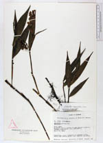
| Family | Orchidaceae |
| Identification | Elleanthus magnicallosus Garay |
| Determined by | C.H. Dodson (MO), 1991. |
| Identification qualifier | |
| Field notes | Caespitose, erect lithophyte on roadside cliffs. Sepals and lateral petals clear magenta. Lip white. |
|
 Other records of Elleanthus magnicallosus