AAU Herbarium Database |
| New Search Modify Search |
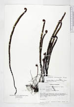
| Collector | Lojtnant, B. |
| Number | 11698 |
| Collected with | Molau, U. |
| Country | Ecuador |
| Subpart | NAPO |
| County | |
| Locality | N side of Laguna Verdecocha, 2 km E of the peak of Cerro Quilindaña, Cordillera Oriental. Open thicket on rocky N-facing slope, surrounded by grass paramo. |
| Coordinates | 0° 47' S 78° 21' W |
| Minimum elevation (m) | 4100 |
| Maximum elevation (m) | 4100 |
| Start date | 1979/04/01 |
| End date | 1979/04/01 |
| Family | Pteridaceae |
| Identification | Jamesonia cinnamomea Kunze |
| Determined by | Arbelaez, A. L. (MO), 2000. |
| Identification qualifier | |
| Field notes | Terrestrial. |
| |
 Other records of Jamesonia cinnamomea Other records of Jamesonia cinnamomeaThe map displays only records from the Aarhus Herbarium Database. The records may not represent the full distribution of Jamesonia cinnamomea |
| New Search Modify Search |